EXAMPLES
Below are some examples of the benefits of seeing your property on Google Earth.
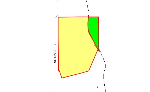
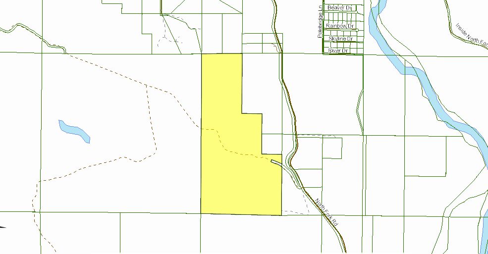
- The first image is a simple parcel map.
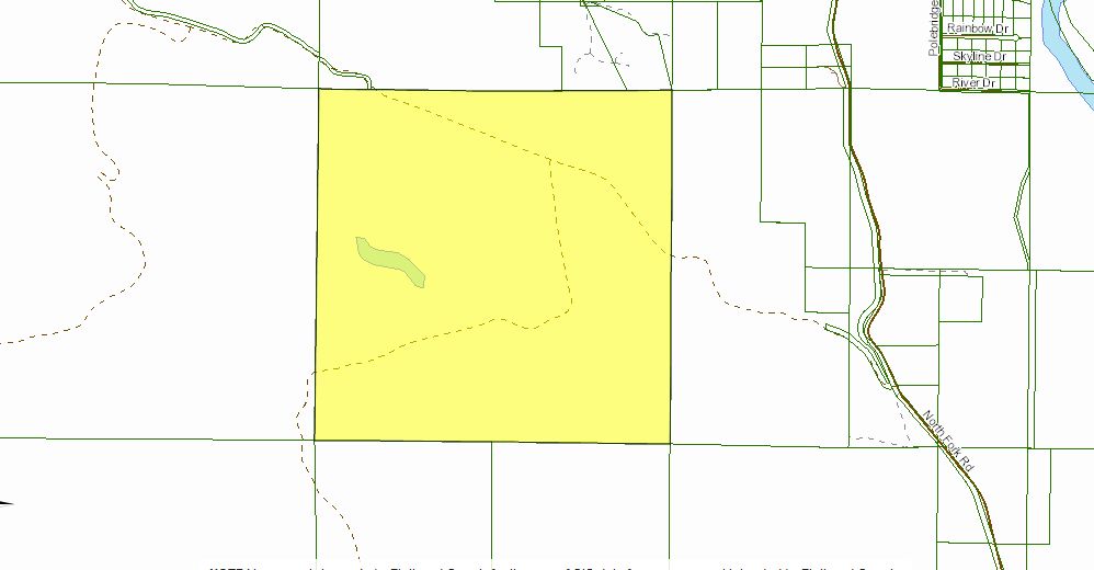
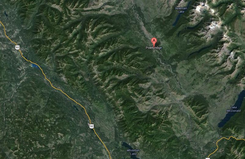
- The second image is a view from Google Maps of the area. There is no outline of the property and no sense of the topography of the property or the surrounding area.
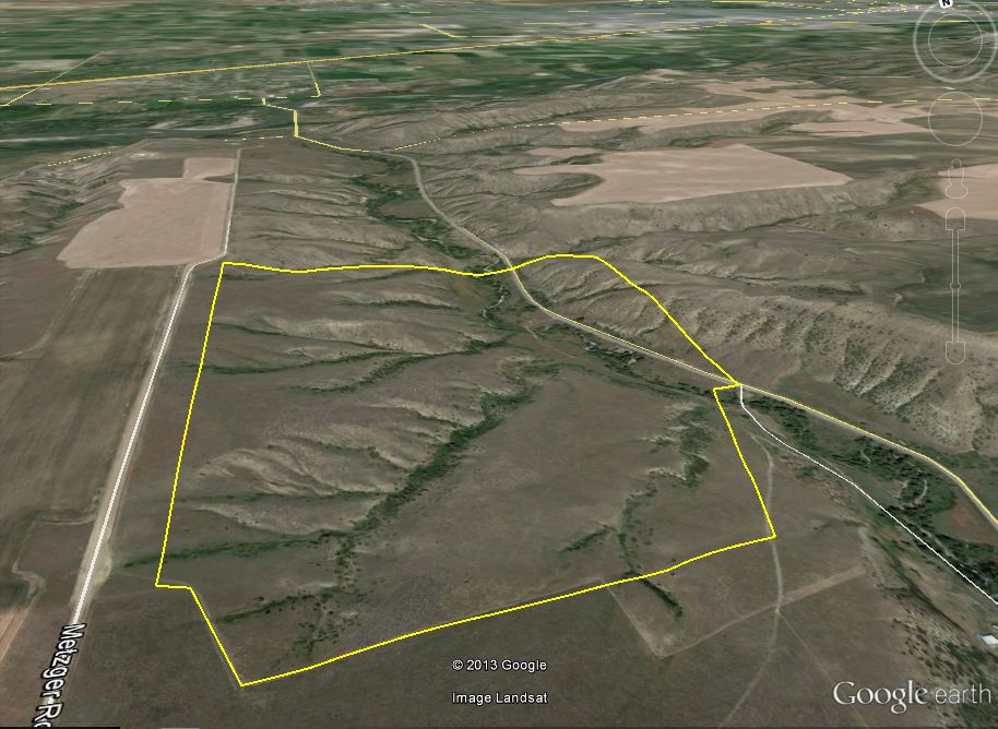
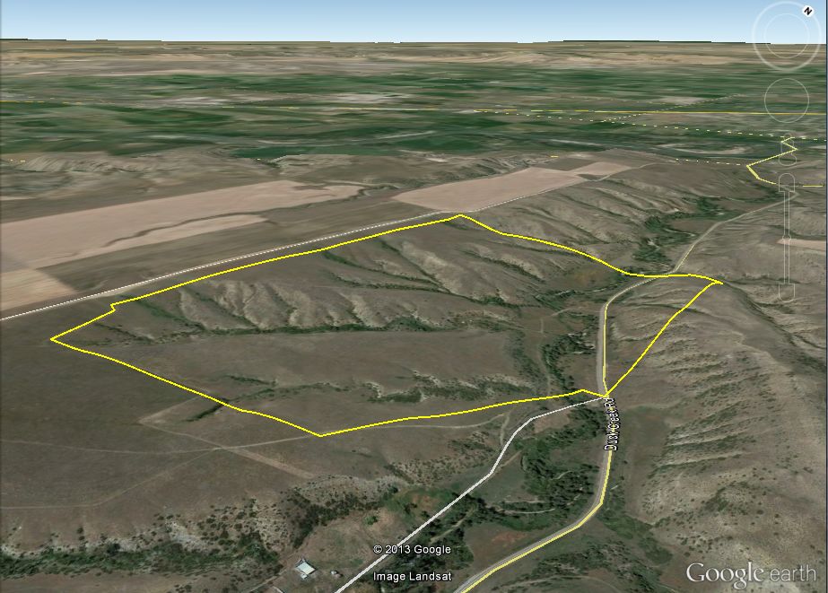
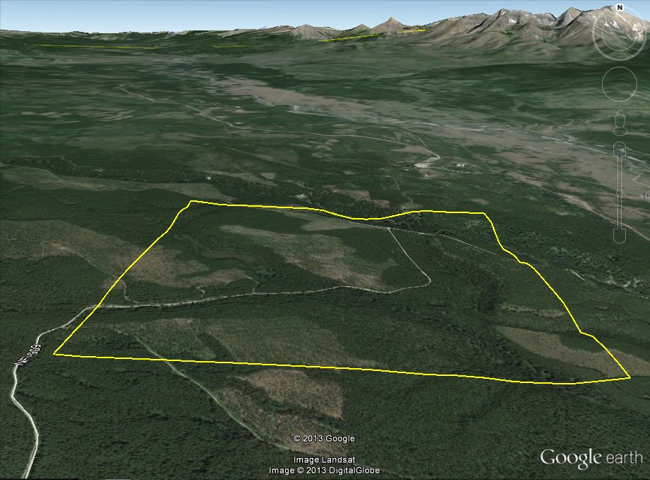
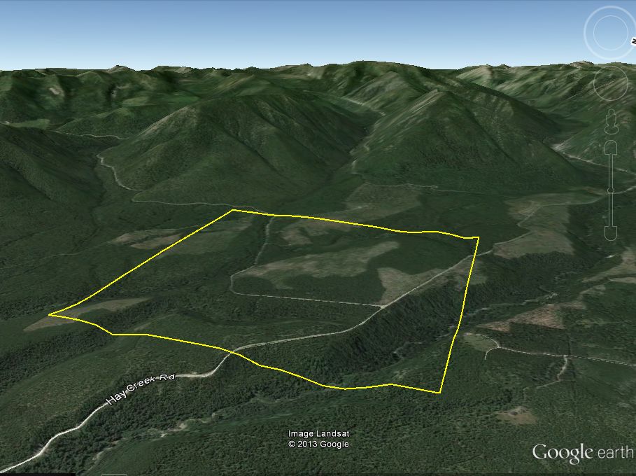
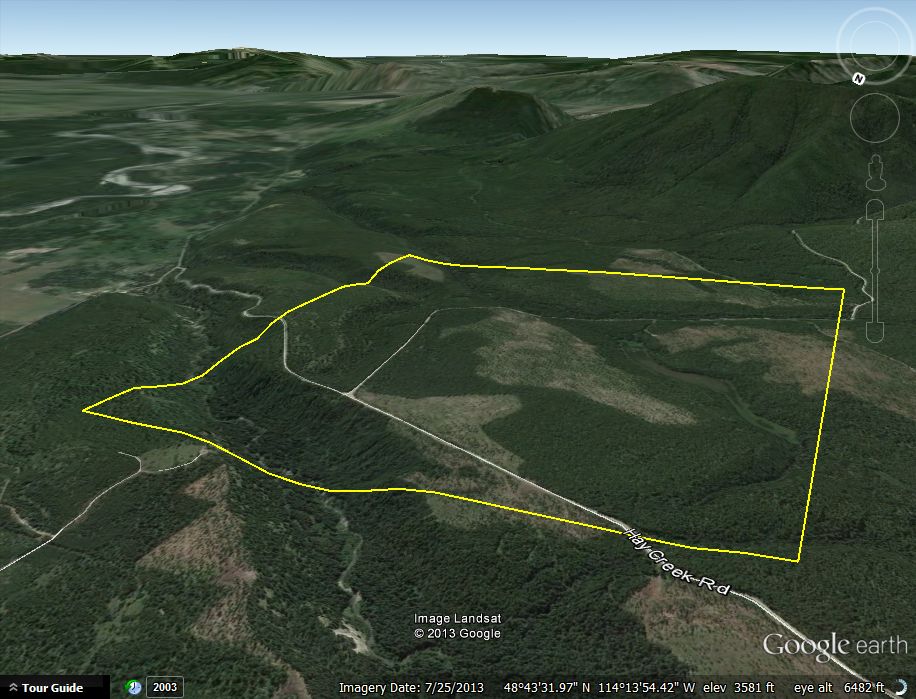
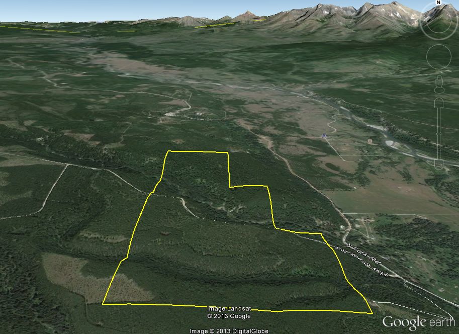
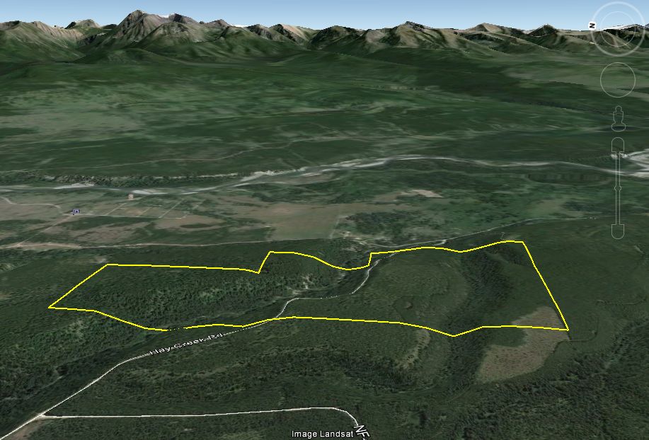
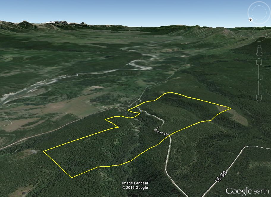
- The 3rd - 5th images are screenprints from Google Earth using the file we would produce for you. You can clearly see the topography of the area. In Google Earth, you can rotate the view 360 degrees and change the elevation to see the property from any angle.
Sample Property 1 (click on image for a larger view)
|

|
|
|

|
Sample Property 2 (click on image for a larger view)
|
|
|
|
|
Sample Property 3 (click on image for a larger view)
|

|
|
|
|
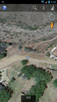
From your mobile device, you can open one of these files in Google Earth and it will show you your location in relation to the property borders. Navigate Google Earth 360 degrees around, change the elevation and zoom in or out. See your property from every possible angle while you're in the field!
Great for:
As long as you have the file saved on your mobile device, you do not need a phone signal to view the images. You just need a satellite signal.
Great for:
- real estate professionals
- hikers
- hunters
- outdoorsmen
As long as you have the file saved on your mobile device, you do not need a phone signal to view the images. You just need a satellite signal.
